Farm Mapping &GIS Services
Professional drone-based mapping services providing high-resolution imagery, precise GIS data, and comprehensive field analysis for accurate farm management and planning decisions.
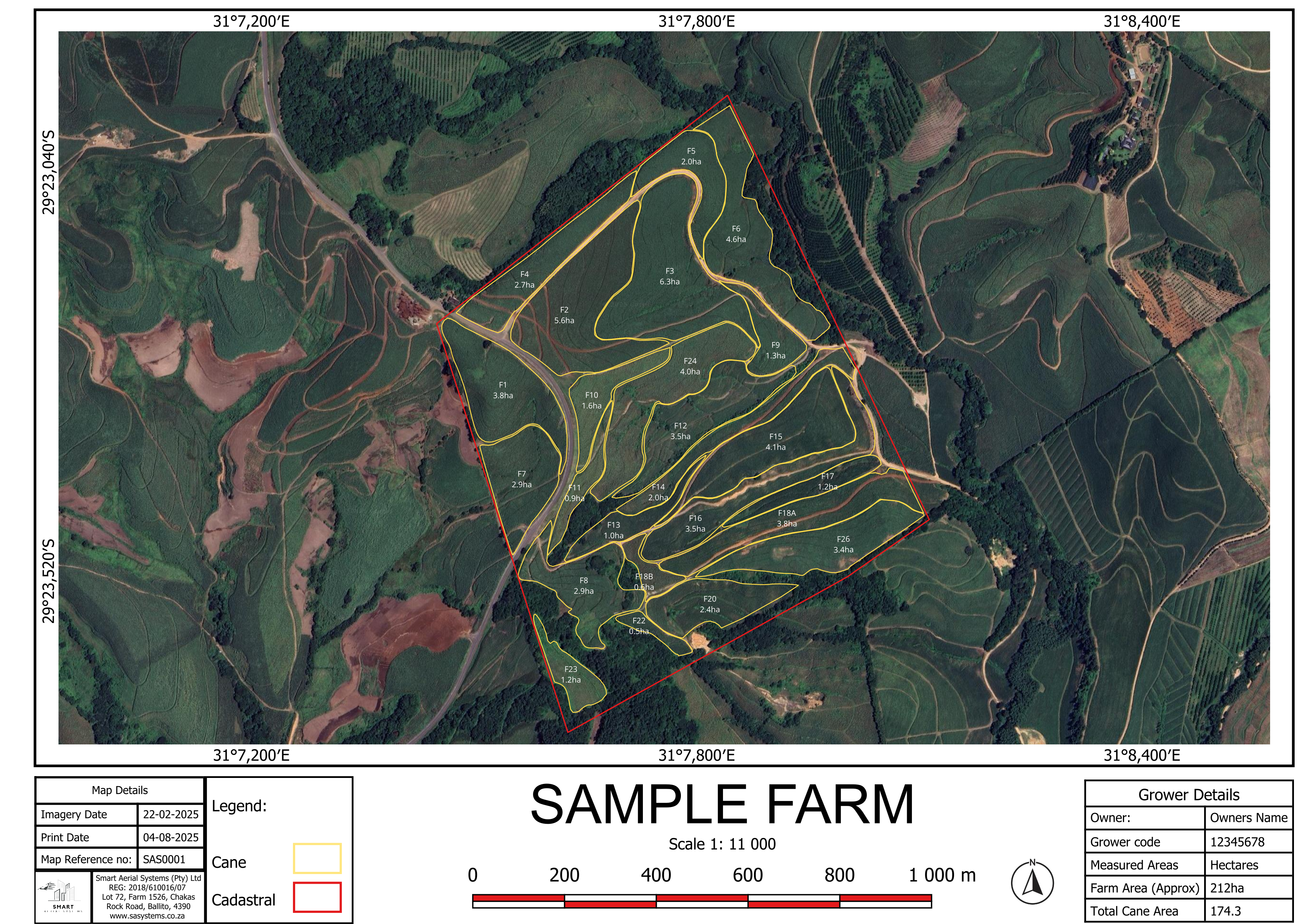
High-Resolution Imagery
Capture detailed aerial photos with sub-centimeter accuracy using professional-grade drone cameras and sensors.
GIS Integration
Advanced Geographic Information System mapping with precise GPS coordinates and seamless data integration.
Field Boundary Mapping
Accurate field boundary detection and mapping for precise area calculations and property management.
3D Terrain Modeling
Create detailed elevation maps and 3D terrain models for drainage analysis and topographical planning.